Parking Commission Backs Broadened Scope Covering Recreation, Open Space, and Undeveloped Zoning With Potential Two-Thirds Federal Grant
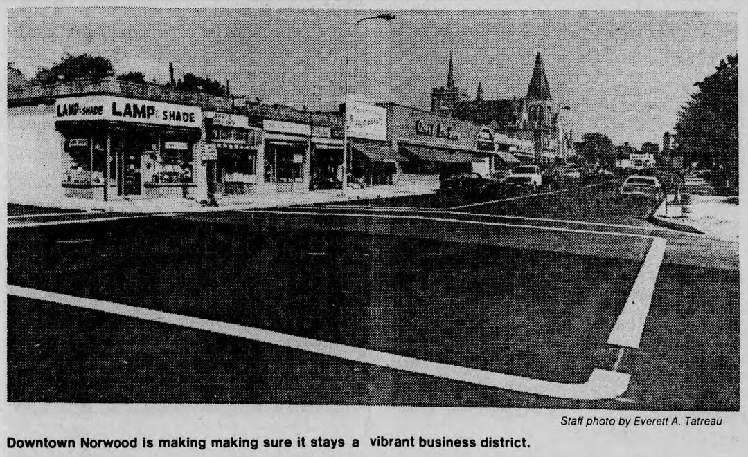
NORWOOD – The Norwood Planning Board voted on Monday night, November 20, 1967, to expand its proposed study of Norwood’s Central Business District (CBD) into a comprehensive, town-wide planning survey encompassing recreation and open space requirements as well as zoning strategies for the municipality’s remaining undeveloped land. Board members stressed that while the survey’s primary emphasis would remain focused on the commercial needs and future development potential of the downtown Central Business District, a broader town-wide framework was essential to guide Norwood’s long-term growth.
Planners unveiled the expanded proposal during a joint session with the Norwood Parking Commission, drawing a favorable reception from commission members after weeks of friction between the two panels. At earlier meetings, the boards had clashed over the project’s scope—with the Parking Commission favoring a narrow inquiry limited to downtown parking capacity and apartment housing needs, while the Planning Board opposed restricting the study to the central core alone.
According to Planning Board estimates, the comprehensive survey would cost approximately $20,000, with a federal government planning grant potentially underwriting up to two-thirds of the total expense. Planning Board Chairman J. Edward Bamber stated that the board would learn later that week whether Norwood satisfied federal eligibility criteria for the matching grant. To build town-wide consensus, the Planning Board actively sought endorsements from both the Board of Selectmen and the Conservation Commission, requesting a formal joint conference with selectmen for the following Tuesday.
1967 Proposed Norwood CBD & Town Planning Study Cost Adjusted to 2026 Dollars
Inflation-adjusted using U.S. Bureau of Labor Statistics CPI data ($1.00 in Nov. 1967 ≈ $9.62 in 2026)
| 1967 Comprehensive Planning Survey Item | 1967 Estimate | 2026 Equivalent |
|---|---|---|
| Total Estimated Comprehensive CBD & Town Survey Cost | $20,000 | ~$192,400 |
| Potential Federal Grant Share (Up to Two-Thirds) | ~$13,333 | ~$128,267 |
| Estimated Local Town Share (One-Third) | ~$6,667 | ~$64,133 |
Archival Note: This article has been dynamically reconstructed from the original public record print archives of the Patriot Ledger
-
1923 Planning Board Report-Existing East-West Through Streets and Diagonals
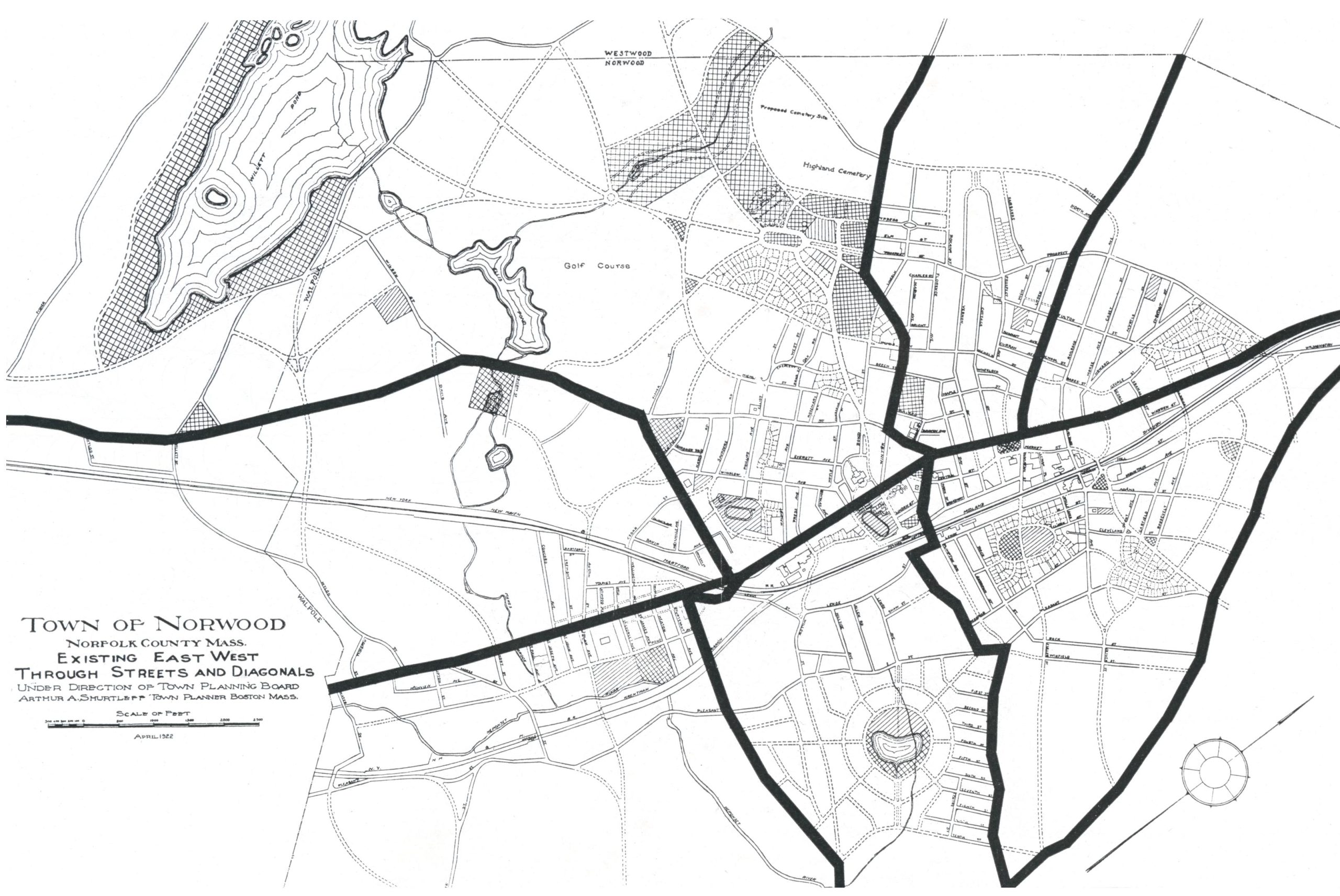
When the main thoroughfares of Norwood were laid out a century or more ago for a convenient approach to fields and pastures and to connect knots of houses or villages with one another, less continuity was secured in the east-west routes than the north-south. As the north-south streets served to connect Boston with Providence and…
-
1923 Planning Board Report-Proposed Additional East-West Through Streets and Diagonals
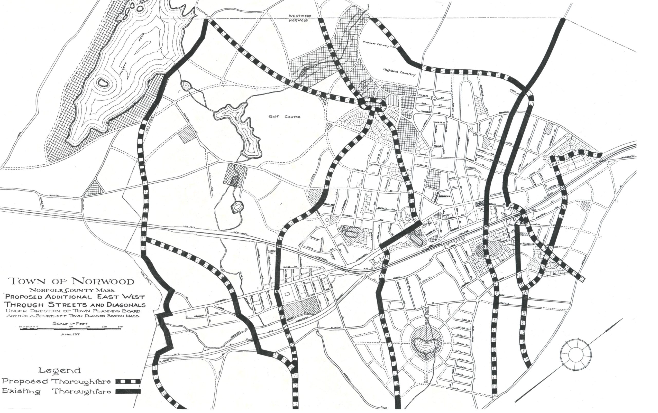
In the wide interspaces between the existing east-west thoroughfares there are many local streets already built, and many more contemplated or actually under construction. Gradually, in a long term of years, all these wild lands will be traversed by roads as the population of the Town increases. These roads will be built by private initiative…
-
1923 Planning Board Report-Existing North-South Through Streets

The existing through streets of Norwood, as shown above, were laid out in times before the construction of the steam railroads, before the large industries were established, and, of course, long before the development of modern housing and the beginnings of motor vehicle transportation. These through streets belong to the epoch of the chaise, the…
-
1923 Planning Board Report-Proposed Additional North-South Through Streets and Diagonals
In the outlying districts of the Town where new houses and new streets are springing up, the individual land owners have used and are still using customary skill and foresight in the planning of individual lots to meet the desires of house builders and to make the lots accessible from the local streets of these…
-
1923 Planning Board Report-Development of Clark Swamp District
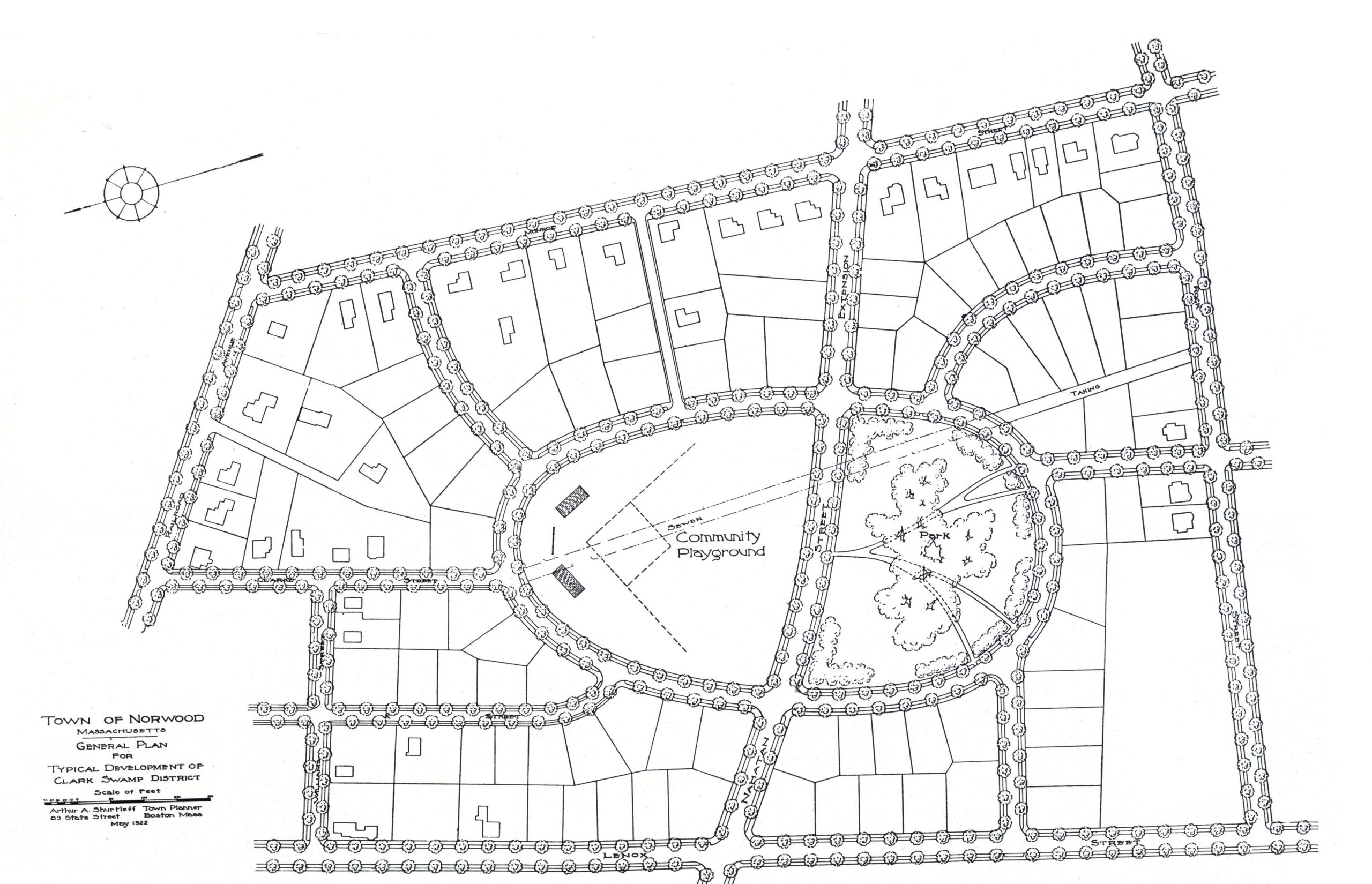
The built-up area of Norwood is gradually approaching the margins of the Clark Swamp district. Under good or bad planning this entire neighborhood is destined to be crossed by streets and built up with dwellings. The cost of this work will be borne inevitably by the citizens of the Town. If good planning is applied…
-
1923 Planning Board Report-Schools, Parks and Playgrounds
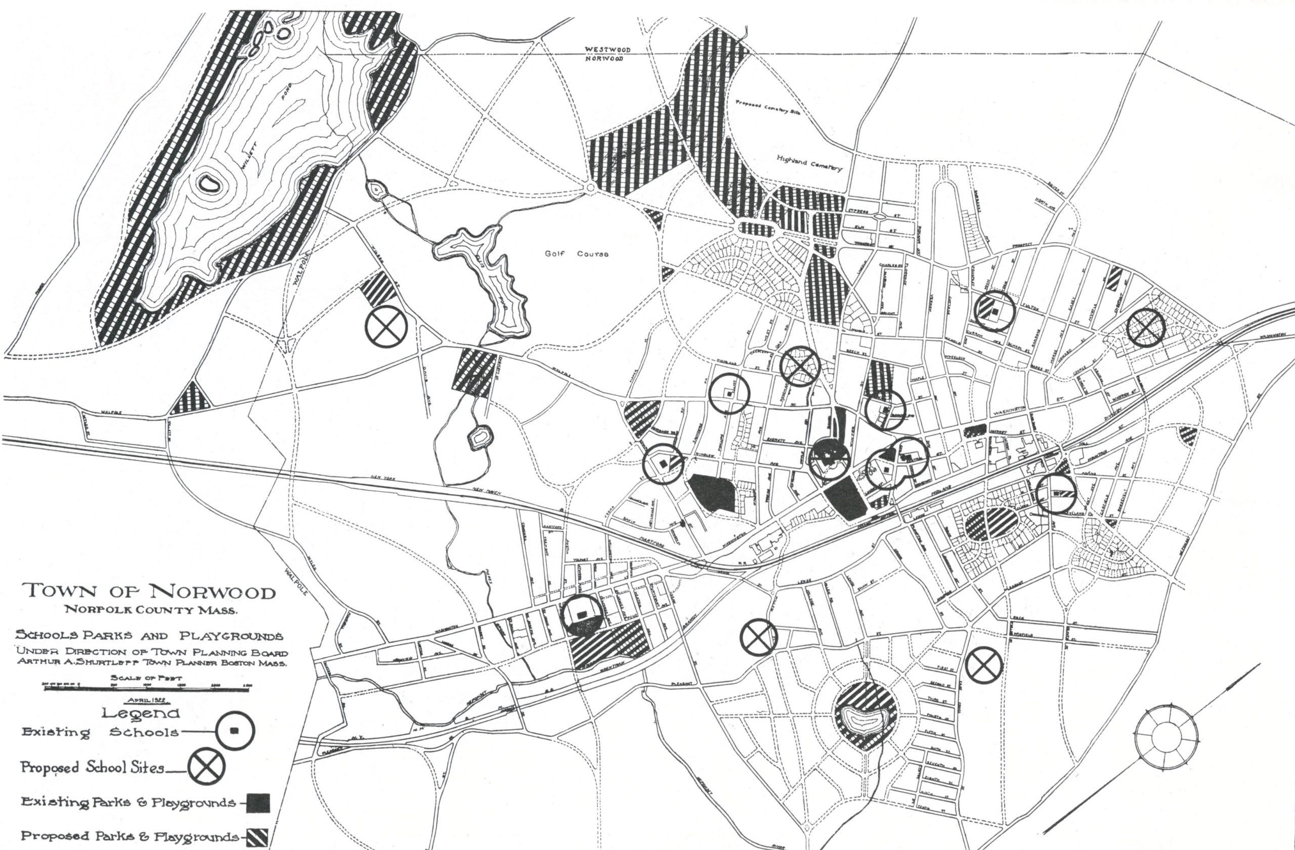
On the accompanying map are shown the public schools of Norwood. They are grouped most closely near the center of the Town with scattered buildings on the outskirts. Evidently school locations will follow the centers of new growth, but the extent to which these structures will be scattered depends upon the policies adopted in the…
-
1923 Planning Board Report-Streets Near Norwood Railroad Station
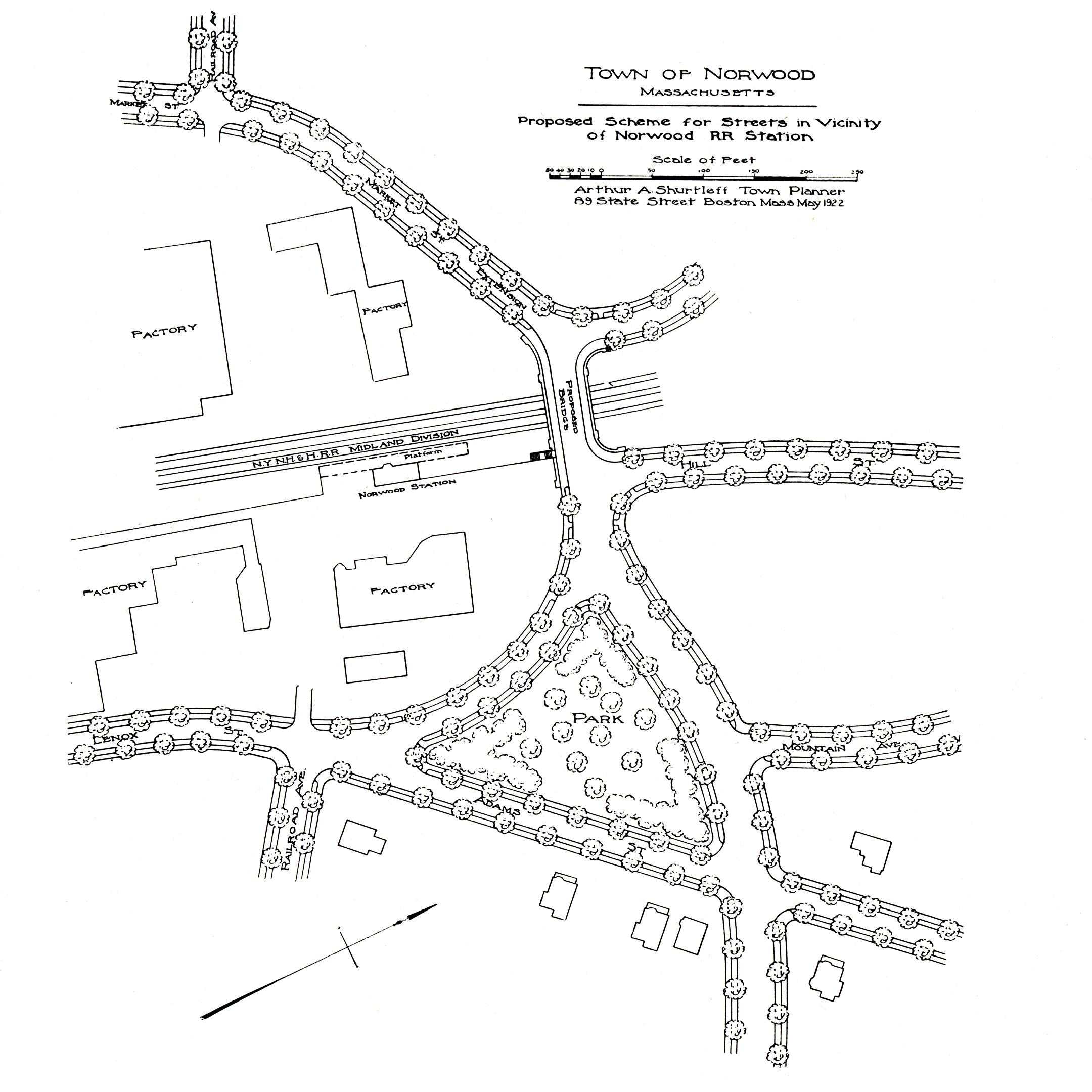
In the course of the general program of the state for the abolishment of railway grade crossings, the present dangerous crossing at Railroad Avenue will be abolished. This work should be undertaken, however, not only with an eye to the safety of persons crossing the tracks, but with consideration of adequate communication across the Town.…
-
1923 Planning Board Report-Vicinity of High Bridge

The complicated and dangerous arrangement of roadways, railway tracks for electric and steam cars, in combination with a narrow underpass in the High Bridge district illustrates forcibly the costly results of allowing important road junctions to “happen by chance.” It is true that these junctions were created at a time when traffic in this neighborhood…
-
1923 Planning Board Report-Plan For Parkway
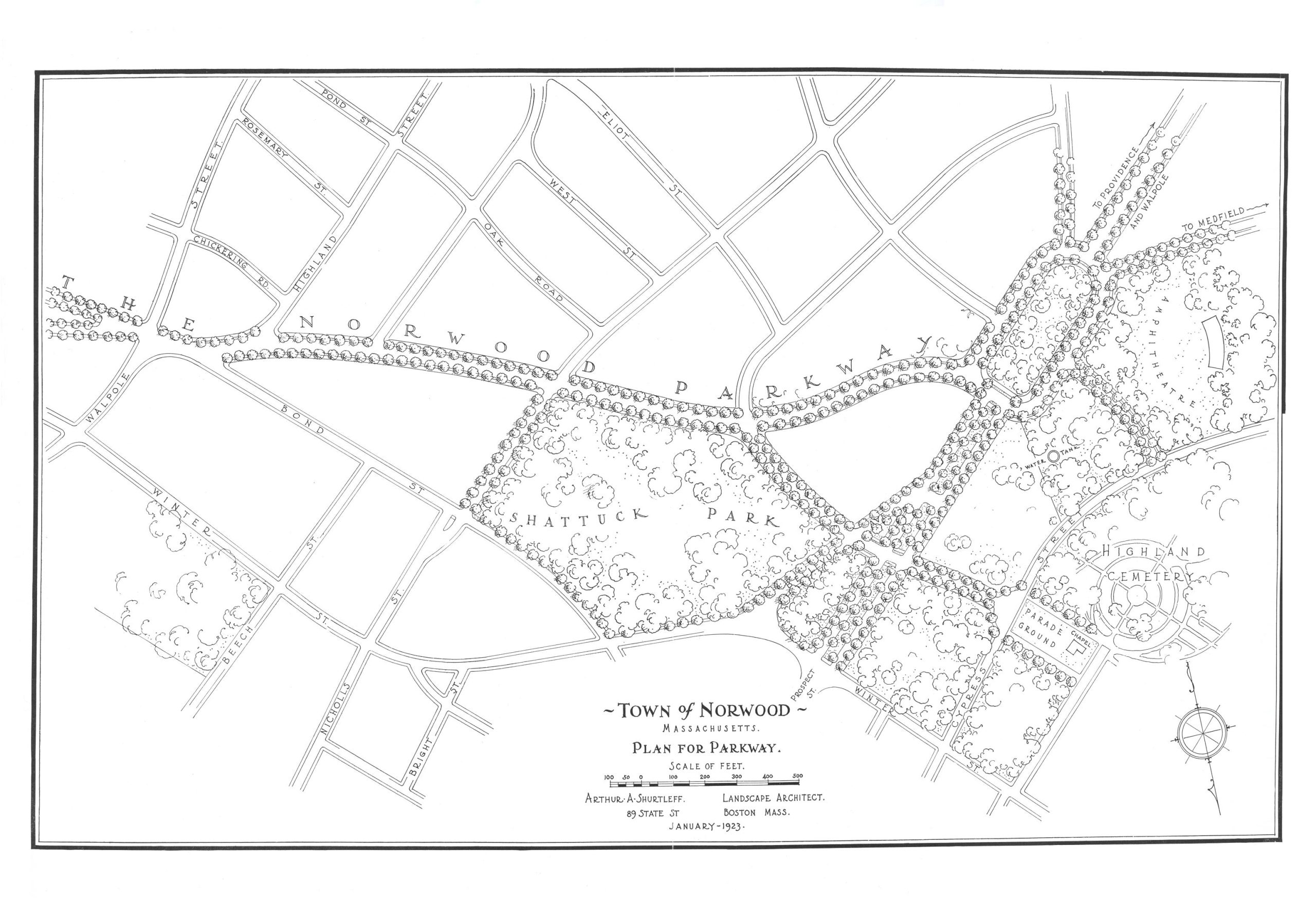
Discover more from Norwood Historical Society Subscribe to get the latest posts sent to your email. Type your email… Subscribe
-
Planning Board Records Remain Largely Missing After Eighteen Months-July 18, 1991
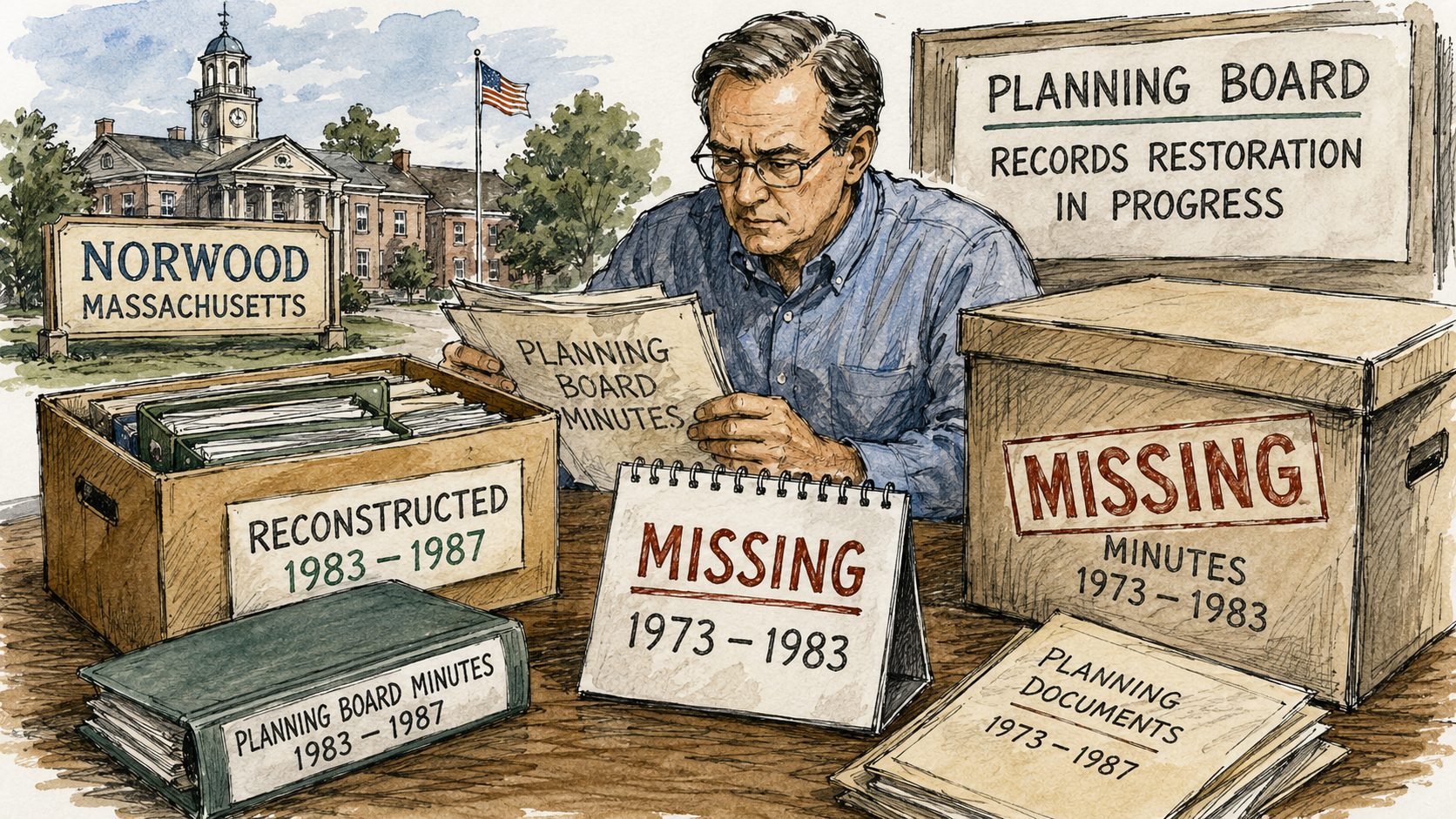
Minutes from 1973 to 1983 remain missing, complicating the town’s ability to track official votes and planning decisions from that era.
Discover more from Norwood Historical Society
Subscribe to get the latest posts sent to your email.