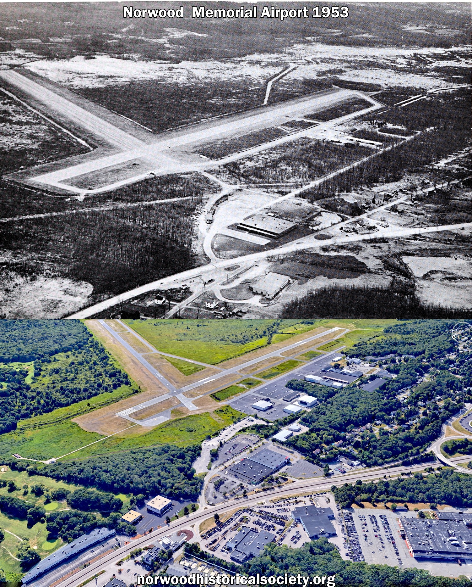
This view of Norwood Airport shows how relatively undeveloped the area still was in 1953. Center right of the photo shows that the airport itself was much smaller, with most of the airport buildings near the far end of Access Road.

The wooded area in the center of the photo houses many of the planes and helicopters in hangers today.
Toward the bottom of the photo in the center is the intersection of Neponset Street and Route 1. Today Pendergast circle is used to access the other side of Neponset street but it had not yet been built in 1953, almost 20 years after the construction of Route 1.
🏛️ Like what you saw? Tap like, leave a comment, or share it on Instagram, Reddit, or in your neighborhood group chat. Someone out there still remembers that steeple, storefront, or schoolyard.
Discover more from Norwood Historical Society
Subscribe to get the latest posts sent to your email.